


Highway Voting District, Okanogan County, Washington
About
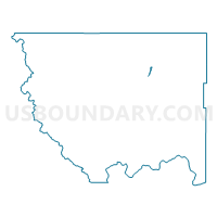
Outline

Summary
| Unique Area Identifier | 687665 |
| Name | Highway Voting District |
| County | Okanogan County |
| State | Washington |
| Area (square miles) | 0.68 |
| Land Area (square miles) | 0.58 |
| Water Area (square miles) | 0.10 |
| % of Land Area | 85.31 |
| % of Water Area | 14.69 |
| Latitude of the Internal Point | 48.75114190 |
| Longtitude of the Internal Point | -119.42242220 |
Maps


Graphs
Select a template below for downloading or customizing gragh for Highway Voting District, Okanogan County, Washington


Neighbors
Neighoring Voting District (by Name) Neighboring Voting District on the Map
- Antoine Creek Voting District, Okanogan County, WA
- Cayuse Mtn Voting District, Okanogan County, WA
- Duffys Mtn Voting District, Okanogan County, WA
- Ellisforde Voting District, Okanogan County, WA
- Janis Voting District, Okanogan County, WA
- North Tonasket Voting District, Okanogan County, WA
- Whitestone Voting District, Okanogan County, WA
- Yarnell Voting District, Okanogan County, WA